The Galactic Free Press
Published on The Galactic Free Press (//soundofheart.org/galacticfreepress)

Home > NSDIC: Arctic & Antarctic Sea Ice Extent, 1979-2012 animated maps

NSDIC: Arctic & Antarctic Sea Ice Extent, 1979-2012 animated maps [1]

Rain's picture

Submitted by Rain on Sat, 03/16/2013 - 05:20

Source: The Watchers [2]- 3/16/13, By Chillymanjaro
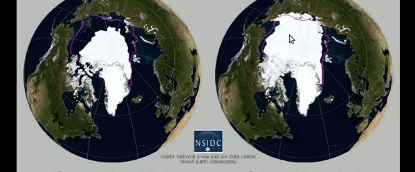
In October 2012, National Snow and Ice Data Center (NSIDC) released an animated map of 2012 Arctic and Antarctic sea ice extent shown side-by-side with 1979 – 2009 climatology.     For more information and visualizations of thinning sea ice, see the NOAA Climate Watch article, “Arctic Sea Ice Getting Thinner, Younger.” Source: NSDIC No related posts.


In October 2012, National Snow and Ice Data Center (NSIDC) [3] released an animated map of 2012 Arctic and Antarctic sea ice extent shown side-by-side with 1979 – 2009 climatology.


For more information and visualizations of thinning sea ice, see the NOAA Climate Watch article, “Arctic Sea Ice Getting Thinner, Younger.” [4]

Source: NSDIC [5]

Tags: 

  • earth changes [6]
  • The Watchers [7]

Category: 

  • Earth & Space Weather [8]

Source URL: //soundofheart.org/galacticfreepress/content/nsdic-arctic-antarctic-sea-ice-extent-1979-2012-animated-maps

Links
[1] //soundofheart.org/galacticfreepress/content/nsdic-arctic-antarctic-sea-ice-extent-1979-2012-animated-maps
[2] http://thewatchers.adorraeli.com/2013/03/16/nsdic-arctic-antarctic-sea-ice-extent-1979-2012-animated-maps/
[3] http://nsidc.org/
[4] http://www.climatewatch.noaa.gov/article/2012/arctic-sea-ice-getting-thinner-younger
[5] http://www.youtube.com/user/NSIDC1?feature=watch
[6] //soundofheart.org/galacticfreepress/tags/earth-changes
[7] //soundofheart.org/galacticfreepress/tags/watchers-0
[8] //soundofheart.org/galacticfreepress/type-post/earth-space-weather