NSDIC: Arctic & Antarctic Sea Ice Extent, 1979-2012 animated maps

Rain's picture

Source: The Watchers - 3/16/13, By Chillymanjaro
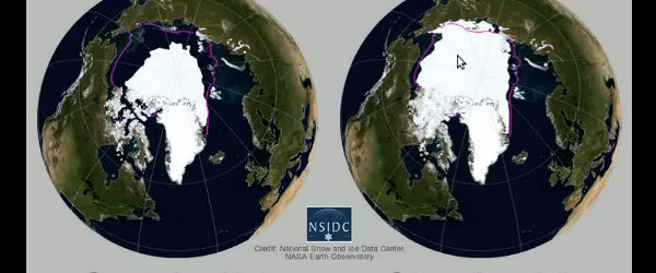
In October 2012, National Snow and Ice Data Center (NSIDC) released an animated map of 2012 Arctic and Antarctic sea ice extent shown side-by-side with 1979 – 2009 climatology.     For more information and visualizations of thinning sea ice, see the NOAA Climate Watch article, “Arctic Sea Ice Getting Thinner, Younger.” Source: NSDIC No related posts.


In October 2012, National Snow and Ice Data Center (NSIDC) released an animated map of 2012 Arctic and Antarctic sea ice extent shown side-by-side with 1979 – 2009 climatology.


For more information and visualizations of thinning sea ice, see the NOAA Climate Watch article, “Arctic Sea Ice Getting Thinner, Younger.”

Source: NSDIC

Tags: 

Category: