
Earthsky.org - 9/29/13, Deborah Byrd
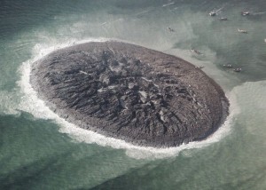
The deadly earthquake that struck Pakistan on September 24, 2013 – leaving 515 people dead and 100,000 homeless – also created a new earthly landform. A new mud island now lies offshore in the Paddi Zirr (West Bay) near Gwadar, Pakistan. It is some 380 kilometers (230 miles) from the earthquake’s epicenter. It’s being called being called Zalzala Jazeera – or earthquake island. The first image below shows the new island from space, as seen by NASA’s Earth Observing-1 satellite on September 26. The second image shows the same area on April 17; no sign of an island could be seen at that time.
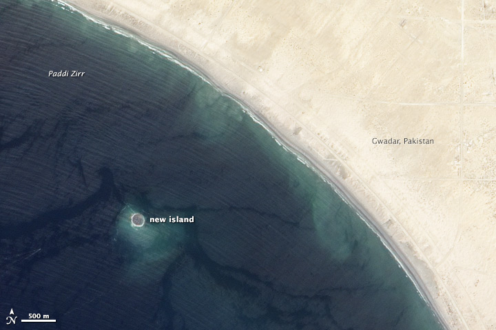
Earthquake island in Paddi Zirr (West Bay) near Swadar, Pakistan. This island rose from the sea following the September 24, 2013 deadly earthquake in Pakistan. NASA Earth Observatory image via Earth-Observing-1 satellite. Read more about the September 24 earthquake.