EarthSky.org - 6/29/13

The June 2013 Black Forest fire was the most destructive in Colorado’s history. The fire charred more than 14,000 acres, killed two people, destroyed 509 homes, and devastated a wooded suburb of Colorado Springs.
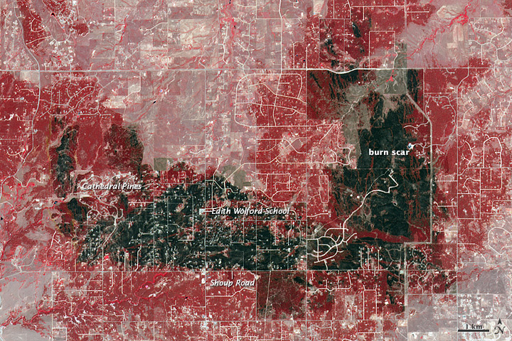
This image of the Black Forest fire’s burn scar was acquired by NASA’s Terra satellite on June 21, 2013. Vegetation-covered land is red in the false-color image, which includes both visible and infrared light. Patches of unburned forest are bright red. Unburned grasslands are pink. The darkest gray and black areas are the most severely burned. Buildings, roads, and other developed areas appear light gray and white
For more information please see EarthSky.org

