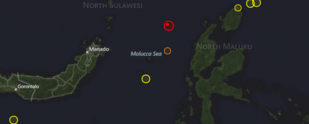
Strong and deep M 6.4 earthquake hit Molucca Sea, Indonesia
BY
ADONAI– AUGUST 26, 2012

Very strong and deep earthquake with recorded magnitude of 6.4 struck Molucca Sea, Indonesia onAugust 26, 2012 at 15:05 UTC, 11:05 pm local time, according to USGS. Both USGS and EMSC recorded preliminary magnitude of 6.8. Epicenter was located 169 km (105 miles) NNW (340°) from Ternate, Moluccas, Indonesia at coordinates 2.231°N, 126.865°E. Recorded depth was 69.7 km (43.3 miles). EMSC later reported magnitude 6.6 and depth of 80 km.
The earthquake was felt in a wide area in Indonesia and the Philippines, mainly because of the deep origin of the hypocenter.
NOAA/NWS – Pacific Tsunami Warning Center evaluated that this earthquake had no destructive widespread tsunami threat based on historical earthquake and tsunami data.
GDACS reported that this earthquake can have a low humanitarian impact based on the Magnitude and the affected population and their vulnerability. About 6000 people live within 100km.

