EARTHQUAKE

Earthquake Report for 05/30/2013

Silver's picture

By: www.earthquake.usgs.gov

20 earthquakes


    5.3 260km S of Muara Siberut, Indonesia 2013-05-30 14:37:00 UTC-04:00 20.0 km

    2.5 50km SSE of Tanana, Alaska 2013-05-30 13:46:40 UTC-04:00 16.7 km

    3.1 60km S of Cantwell, Alaska 2013-05-30 10:54:01 UTC-04:00 67.7 km

    4.7 17km W of Piru, Indonesia 2013-05-30 10:38:25 UTC-04:00 69.3 km

    2.6 92km NNW of Talkeetna, Alaska 2013-05-30 10:09:44 UTC-04:00 118.0 km

    2.5 18km E of Pahala, Hawaii 2013-05-30 08:31:04 UTC-04:00 6.9 km

    2.8 82km NW of Aguadilla, Puerto Rico 2013-05-30 06:19:03 UTC-04:00 7.0 km

    4.4 71km NNE of Isangel, Vanuatu 2013-05-30 04:55:32 UTC-04:00 258.4 km

    2.8 9km E of Gilroy, California 2013-05-30 02:32:48 UTC-04:00 9.6 km

    2.7 6km W of Isla Vista, California 2013-05-30 02:11:54 UTC-04:00 10.4 km

    3.5 20km NNE of Shawville, Canada 2013-05-30 01:35:00 UTC-04:00 13.3 km

    2.8 84km NNW of Talkeetna, Alaska 2013-05-30 01:08:31 UTC-04:00 118.2 km

4.6 magnitude earthquake strikes off Santa Barbara coast

Silver's picture

By: Theextinctionprotocol.wordpress.com, 05/29/2013


CALIFORNIA - A magnitude-4.6 earthquake struck off the Santa Barbara coast Wednesday morning, according to the U.S. Geological Survey. The temblor struck at 7:38 a.m. about three miles west of Isla Vista, the USGS reported. Initial reports indicated that the quake had a magnitude of 4.9, but that was later adjusted to 4.6. The Santa Barbara County Sheriff’s Department said there were no immediate reports of damage or injuries.


For more on this story visit www.theextinctionprotocol.wordpress.com

Earthquake Report for 05/29/2013

Silver's picture

By: Earthquake.usgs.gov


24 earthquakes


    2.5 7km W of Isla Vista, California 2013-05-29 15:05:12-04:00 9.3 km deep

    2.8 92km SW of Anchor Point, Alaska 2013-05-29 15:04:24-04:00 98.4 km deep

    2.9 114km W of Cantwell, Alaska 2013-05-29 14:44:58-04:00 14.5 km deep

    2.7 20km SE of Downieville, California 2013-05-29 12:24:05-04:00 0.5 km deep

    2.6 8km W of Isla Vista, California 2013-05-29 11:38:40-04:00 10.3 km deep

    2.6 6km WNW of Isla Vista, California 2013-05-29 10:50:02-04:00 9.5 km deep

    5.1 Prince Edward Islands region 2013-05-29 10:47:33-04:00 10.1 km deep

    4.5 13km ESE of Demirci, Turkey 2013-05-29 10:43:34-04:00 17.6 km deep

    4.8 5km W of Isla Vista, California 2013-05-29 10:38:03-04:00 8.0 km deep

    3.4 30km WNW of Willow, Alaska 2013-05-29 10:33:50-04:00 49.3 km deep

    3.1 18km NW of Garland, Utah 2013-05-29 09:32:41-04:00 1.2 km deep

    4.7 77km WSW of Port-Vila, Vanuatu 2013-05-29 07:25:33-04:00 10.1 km deep

Arkansas Quake Swarms Rattle Nerves, Raise Questions

Silver's picture

CNN, By: Alan Duke, 05/27/2013


Three dozen earthquakes over the past week in central Arkansas shook shelves, rattled nerves and prompted speculation about their cause. "Are they being being triggered or are they natural? That's something we don't know," Arkansas Geological Survey scientist Scott Ausbrook said Sunday.


The chances of so many temblors in the region in such a short time are "Powerball kind of odds," Ausbrook said. "What was unusual was to have four different areas in the state to be active in the same week." More than two dozen quakes recorded since Wednesday have been centered north of Morrilton, Arkansas. The strongest, on Wednesday and Thursday nights, had reported magnitudes of 3.5 and 3.4.


For more on this story visit www.cnn.com

Earthquake in Irish Sea causes intense shaking in North Wales: largest quake in 29 years

Silver's picture

Theextinctionprotocol.wordpress.com, 05/29/2013


WALES – An earthquake on the North Wales shoreline has been felt over an area of 140 km. People were woken by the quake which happened at around 4.15 am and was felt as far away as Southport in Merseyside. The epicenter was 13km northwest of the town of Abersoch, Gwynedd, on the Lleyn Peninsula and measured a magnitude of 3.8, the British Geological Survey (BGS) said. Some 180 reports from people who felt the earthquake have been made to the BGS, who said the majority were within a 50 to 75 km radius.


For more on this story visit www.theextinctionprotocol.wordpress.com

Earthquake Timeline in the UK

Silver's picture

BGS, By: British Geological Survey, 05/29/2013


The UK is not generally associated with earthquakes, however, between 20 to 30 earthquakes are felt by people each year, and a few hundred smaller ones are recorded by sensitive instruments. Most of these are very small and cause no damage.


However, some British earthquakes have caused considerable damage, although nothing like the devastation caused by large earthquakes in other parts of the world.


For more on this story visit www.bgs.ac.uk

Earthquake Report for 05/28/2013

Silver's picture

By: www.earthquake.usgs.gov

21 earthquakes


    5.0 115km SSE of Katsuura, Japan 2013-05-28 15:24:25-04:00 35.8 km deep

    3.2 86km NE of Fort Yukon, Alaska 2013-05-28 14:00:24-04:00 10.6 km deep

    5.3 88km ENE of Petropavlovsk-Kamchatskiy, Russia 2013-05-28 12:25:33-04:00 71.7 km deep

    2.5 26km W of Volcano, Hawaii 2013-05-28 10:57:33-04:00 9.7 km deep

    4.5 93km W of Sinabang, Indonesia 2013-05-28 10:24:55-04:00 25.1 km deep

    4.5 92km WNW of Sinabang, Indonesia 2013-05-28 10:12:40-04:00 30.0 km deep

    2.7 31km WSW of Page, Arizona 2013-05-28 09:32:02-04:00 6.0 km deep

    4.3 119km ENE of Amahai, Indonesia 2013-05-28 06:45:39-04:00 39.0 km deep

    4.6 101km ENE of Amahai, Indonesia 2013-05-28 06:24:07-04:00 23.6 km deep

    4.4 Sea of Okhotsk 2013-05-28 04:58:39-04:00 627.1 km deep

    5.0 120km SE of Ndoi Island, Fiji 2013-05-28 04:45:53-04:00 408.4 km deep

Earthquake Report for 05/27/2013

Silver's picture

By: www.earthquake.usgs.gov

28 earthquakes


    2.5 3km NNE of San Ramon, California 2013-05-27 14:41:54-04:00 18.9 km deep

    2.6 15km SW of Westwood, California 2013-05-27 11:44:38-04:00 1.3 km deep

    3.2 10km S of Pole Ojea, Puerto Rico 2013-05-27 11:40:41-04:00 5.0 km deep

    4.7 61km WSW of Kirakira, Solomon Islands 2013-05-27 10:34:35-04:00 68.4 km deep

    5.2 14km NE of Namatanai, Papua New Guinea 2013-05-27 07:29:28-04:00 466.6 km deep

    2.6 6km W of Greenville, California 2013-05-27 07:20:22-04:00 0.0 km deep

Earthquake Report for 05/26/2013

Silver's picture

By: www.earthquake.usgs.gov/earthquakes/map/


28 earthquakes


    4.8 South of the Fiji Islands 2013-05-26 14:14:03-04:00 131.4 km deep

    3.1 96km NNW of San Antonio, Puerto Rico 2013-05-26 12:21:55-04:00 45.0 km deep

    5.0 15km ESE of Bejaia, Algeria 2013-05-26 12:00:55-04:00 14.6 km deep

    2.9 29km NW of Okanogan, Washington 2013-05-26 11:10:15-04:00 9.8 km deep

    3.4 9km NW of Avenal, California 2013-05-26 10:01:08-04:00 10.2 km deep

    4.7 239km ENE of Enarotali, Indonesia 2013-05-26 09:04:32-04:00 74.0 km deep

    4.0 72km WNW of Aba, China 2013-05-26 09:02:34-04:00 13.0 km deep

    4.1 Sea of Okhotsk 2013-05-26 08:40:59-04:00 599.4 km deep

    4.8 93km NE of Amuntai, Indonesia 2013-05-26 08:25:13-04:00 14.8 km deep

    5.0 95km SW of Pasarbaru, Indonesia 2013-05-26 07:20:00-04:00 43.8 km deep

    2.5 104km N of Charlotte Amalie, U.S. Virgin Islands 2013-05-26 06:48:28-04:00 41.0 km deep

Earthquake Report for 05/25/2013

Silver's picture

Earthquake report for 05/25/2013

By: www.earthquake.usgs.gov/earthquakes/map/
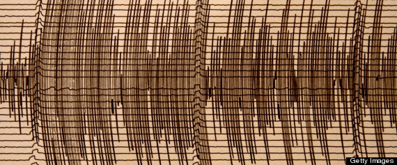
35 earthquakes - 2013-05-25 15:47:45-04:00


    3.5 9km WNW of Greenville, California 2013-05-25 14:43:02-04:00 0.0 km deep

    2.9 9km WNW of Greenville, California 2013-05-25 13:35:12-04:00 0.0 km deep

    4.7 South of Java, Indonesia 2013-05-25 13:05:16-04:00 11.3 km deep

    2.5 3km ENE of Lewisville, Washington 2013-05-25 12:40:51-04:00 1.8 km deep

    3.1 64km N of Hatillo, Puerto Rico 2013-05-25 12:06:57-04:00 51.0 km deep

    2.9 8km NE of Sedro-Woolley, Washington 2013-05-25 11:22:59-04:00 8.2 km deep

    2.8 17km SSW of Honoka'a, Hawaii 2013-05-25 11:18:13-04:00 30.1 km deep

    2.6 12km WNW of Greenville, California 2013-05-25 11:04:09-04:00 0.1 km deep

    2.9 60km WSW of Anchor Point, Alaska 2013-05-25 10:52:43-04:00 113.1 km deep

    5.0 West of Macquarie Island 2013-05-25 10:52:42-04:00 10.0 km deep

    2.6 8km WNW of Greenville, California 2013-05-25 10:48:10-04:00 0.0 km deep

    4.7 South of Panama 2013-05-25 10:13:13-04:00 24.9 km deep

    4.1 Off the coast of Oregon 2013-05-25 07:50:55-04:00 10.0 km deep

    5.6 282km ENE of Dili, East Timor 2013-05-25 06:32:55-04:00 110.2 km deep

    2.7 10km SSE of San Juan Bautista, California 2013-05-25 06:12:59-04:00 10.4 km deep

Pages

Subscribe to RSS - EARTHQUAKE