storms

Severe weather moves to the east

Magikalspirit's picture

CNN - 5-21-2013, Josh Leves


cfni.org


The storm system behind Monday's Oklahoma twister brought strong rainstorms to parts of the South on Tuesday evening before heading toward the Great Lakes and the Tennessee Valley.

Tornado watches continued for portions of Texas, Oklahoma, Louisiana, Arkansas, Mississippi, Missouri and Tennessee. Those watches were set to expire by 10 p.m. CT Tuesday.


Read More: http://www.cnn.com

Tropical Depression 02W developed near Philippines

Desert Gypsy's picture

thewatchers.adorraeli.com-2/20/2013,Chillymanjaro


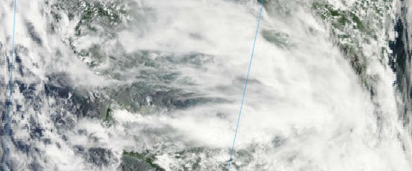
The second tropical depression of the northwestern Pacific Ocean season formed on February 19, 2013 and the system is soaking the central and southern Philippines. Early on February 19, 2013, the low pressure area designated as System 98W organized into a tropical depression and was renamed “02W.” Tropical Depression 02W formed south of Mindanao, the Philippines. TD02W is referred to locally in the Philippines as “Tropical Depression Crising.” TD02W is currently experiencing moderate vertical wind shear, as high as 20 knots (23 mph/37 km/h) which is keeping the depression from getting better organized. That is expected to change, however, once TD02W moves west...


The second tropical depression of the northwestern Pacific Ocean season formed on February 19, 2013 and the system is soaking the central and southern Philippines. Early on February 19, 2013, the low pressure area designated as System 98W organized into a tropical depression and was renamed “02W.” Tropical Depression 02W formed south of Mindanao, the Philippines. TD02W is referred to locally in the Philippines as “Tropical Depression Crising.” TD02W is currently experiencing moderate vertical wind shear, as high as 20 knots (23 mph/37 km/h) which is keeping the depression from getting better organized. That is expected to change, however, once TD02W moves west into the South China Sea.


Storm Reports: Snow, Sleet Cover Northeast Roads

Desert Gypsy's picture
Meghan Evans, Meteorologist February 19, 2013; 5:49 PM


In the above map: Snow/Ice is represented by pink lines. Blue lines represent wet condition


A deadly storm that shut down roads across the Midwest is now taking aim at the Northeast. Snow, sleet and freezing rain are pushing into the interior Northeast on Tuesday, creating slick travel conditions.

Roads are slippery due to the wintry weather across much of New York and Pennsylvania. During the morning hours, travel was impacted all the way down the spine of the Appalachians.


For more information on this story and video please click here.

Pages

Subscribe to RSS - storms